St. Cloud, MN Weather Forecast
Friday, April 25, 2025 2:15 AM
Prepared by Bob Weisman, SCSU Meteorologist and Professor Emeritus
Drying for Today and Tomorrow, Then Periodic Thunderstorm Threats Sat-Mon Nights (Especially Mon PM?)
Thursday Rain Concentrated in Southern Minnesota
The clouds persisted in central Minnesota for all of Thursday (see GeoColor satellite loop from Colorado State satellite slider), so high temperatures barely climbed above 50 (see NWS: last 72 hours of St. Cloud observations). Unfortunately, the rain showers also persisted in southern Minnesota during the daylight hours (set number of frames to 200 on the College of DuPage north central US radar loop). And, the showers weren't as strong as they were further to the south. Much of even southern Minnesota didn't get a lot of rain, except for Fairmont, which has seen 0.60 inches since yesterday. Mankato had 0.45 inch. Otherwise, the rainfall amounts have been light. Minneapolis-St. Paul International Airport has seen 0.20 inch through midnight, while St. Cloud Regional Airport has only a trace of rain as even the stronger thunderstorms that developed in the Dakotas have weakened as they moved into Minnesota.
More Sun Second Half of Today
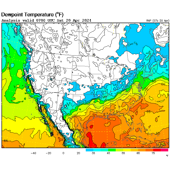
The back edge of the clouds has pushed through most of the Dakotas and is approaching northwestern Minnesota (see GeoColor satellite loop from Colorado State satellite slider), a sign that the slightly drier air over the Dakotas (dew points in the 30's on the UCAR hourly dew point map), will be working in during the day. That should allow sunshine to return for the second half of the day. Highs will return to about 60 degrees.
Warming With Increased Fire Danger Saturday
Tonight, we will be mostly clear and calm, so there is a good chance for the dense fog seen over the Dakotas (see NWS Aviation Weather Center METAR map) to reform over Minnesota. After the fog burns off, tomorrow will end being a sunnier day than today with highs returning to the 60's. The lack of rain, dry air mass, and increasing southeast wind will again produce an elevated fire danger in parts of Minnesota, especially in the driest parts of Minnesota to our west and north.
First Two Rounds of Rain Possible Sat Nt-Early Sun and Late Sun Nt-Early Monday
Then, the first effects of the next storm (counterclockwise rotation off the West Coast on the Pacific mid-tropospheric water vapor loop from Colorado State satellite slider) will begin late Saturday night into Sunday morning. The summer-like humidity now located in the central and southern Plains (see brown areas from eastern Kansas and Missouri southward on the UCAR hourly dew point map) will get pumped northward by persistent southeast winds over the top of the initially drier air in Minnesota. This will set off scattered showers and thunderstorms late Saturday night and Sunday morning. The rainfall may not be huge (see Days 2-3 on the NWS WPC quantitative precipitation forecast), but there could be some locally heavy rains. The warm front won't get into central Minnesota on Sunday, so we are likely to have a lot of clouds around as the dew points climb to near 50. There may also be some showers and thunderstorms late in the day, but the chances will be smaller.
The period from late Sunday night through Monday night appears to have the best chance for widespread rain over Minnesota (see Days 4-5 on the NWS WPC quantitative precipitation forecast). The warm front is forecast to push northward into central Minnesota on Sunday night, so there will be more opportunity for late night and Monday morning showers and thunderstorms as the leading edge of the warmest and most humid air pushes into southern Minnesota. The early forecasts have a bit of a warm plume in the middle atmosphere that may suppress storms a bit better than early Sunday, but that's a shakier forecast for now.
More Storms With Possible, But Not Guaranteed, Severe Weather Monday Late PM and Evening
Then, central and southern Minnesota should break out into the warm and very humid air with dew points probably reaching the 60's, mid-summer levels, in at least southern Minnesota. That will lead to the possibility of more afternoon and evening thunderstorms with the biggest threat for severe weather (see Day 5, and later Day 4, NWS Storm Prediction Center severe weather outlook). The dark brown area is the highest category the severe weather forecasters will issue that far out into the forecast. Some of the computer forecasts are pushing the main rain threat off to the south and east on Monday afternoon (note the higher precipitation amounts in northern Minnesota on the Days 4-5 NWS WPC quantitative precipitation forecast), but it's too early to go with a smaller chance), mainly because a warm plume of air in the middle atmosphere might suppress some of the showers and thunderstorms over Minnesota. The cold front is expected to push through central Minnesota on Monday evening, so some lift will be around. While the severe weather threat is uncertain at this time, you will need to keep track of any severe weather watches and warnings on Monday, possibly during the early morning, but more likely during the afternoon and evening.
70's, Maybe 80 Monday PM
The break between any morning and evening storms will allow high temperatures to climb into the 70's and possibly make a run at 80 degrees in parts of central and more of southern Minnesota.
There will be a shot at a few late Monday night or early Tuesday showers, but the bulk of that precipitation may stay in northern Minnesota. Yeah, some of the computer forecasts are showing a chance that the precipitation ends as snow in northern Minnesota, but it's too early to be sure of that.
Cooler Tuesday, Milder Wed With Next Shower Chance Late in Day
We should return to near average high temperatures in the 50's on Tuesday. Wednesday will likely see a return to highs in the 60's, but Wednesday night into Thursday would be the next rain threat. The potential amounts don't appear to be as high as on Monday. Still, that's 5-6 days down the line.
Detailed St. Cloud, MN, and Vicinity Forecast
Confidence Level: "The Bugs Are Waiting for Me to Mow the Lawn"
Friday 4/25/2025: Cloudy during the morning, then becoming mixed sun and clouds by afternoon with a chance for a stray midday or afternoon rain drop. Back to seasonable warmth. High: between 57 and 62. Winds: NE 5-15 MPH. Chance of measurable rainfall: 20%.
Friday Night: Mostly clear, light winds, and cooler. Areas of dense fog possible late at night. Low: between 35 and 40. Winds: light NE-SE. Chance of measurable rainfall: 10%.
Saturday 4/26/2025: Sunny in the morning, sunshine through high clouds during the afternoon, breezy, and a bit warmer. High: between 60 and 65. Winds: SE 5-15 MPH. Chance of measurable rainfall: 10%.
Confidence Level: "Extra Bugs Will Come From Every Home on the Block to Hover Around My Head"
Saturday Night: Partly clear, breezy, and more moist. A chance for a late night shower or thunderstorm. Milder. Low: between 42 and 47. Winds: SE 8-15 MPH. Chance of measurable rainfall: 40%.
Sunday 4/27/2025: A chance for morning showers and thunderstorms. Some sunny breaks possible during the afternoon. Breezy and more humid during the afternoon. A slight chance for a late day shower or thunderstorm. High: between 58 and 63. Winds: SE 10-20 MPH. Chance of measurable rainfall: 40% in the morning, 20% in the afternoon.
Confidence Level: "Enough Bugs Will Fly into My Mouth to Throw Off My Diet"
Sunday Night: Partly clear, breezy, much warmer, and noticeably humid with a better chance for late night showers and thunderstorms. Low: between 54 and 59. Winds: S-SE 8-15 MPH. Chance of measurable rainfall: 50%.
Monday 4/28/2025: Mixed clouds and sun, very warm, and uncomfortably humid with a chance of both early morning and late day showers and thunderstorms. High: between 75 and 80. Winds: S 8-15 MPH during the morning, SW 15-25 MPH with higher gusts during the afternoon. Chance of measurable rainfall: 40% during the morning, 30% late in the day.
Monday Night: A chance for evening showers and thunderstorms with severe storms possible, then cloudy, windy, and turning much cooler. Maybe a late night sprinkle. Low: between 40 and 45. Winds: SW 8-15 MPH evening, becoming NW 15-30 MPH with higher gusts midnight and early morning. Chance of measurable rainfall: 50%.
Tuesday 4/28/2025: Cloudy through the morning with perhaps a sprinkle, some afternoon sun, breezy, and much cooler. High: between 52 and 57. Winds: NW 15-25 MPH with higher gusts during the morning, 8-15 MPH during the afternoon. Chance of measurable rainfall: 20%.
Extended: Warmer Wednesday with next chance for showers and thunderstorms late in the day??? Few showers Thursday and a bit cooler??
Forecast Confidence (10 - "The Rabbits Will Thump Even Though I Fed Them"; 0 - "The Rabbits Will Offer To Groom My Bald Spot"): 7 Friday through Saturday, 5 Saturday night and Sunday, 3 Sunday night and Monday, 2 Monday night, 3 Tuesday and Wednesday.
Yesterday's High: 52°F; Overnight Low (through 2 AM Friday): ?? (St. Cloud Missing Much of Night)
St. Cloud Airport 24-Hour Melted Precipitation (through 2 AM Friday): Trace; SCSU 24-Hour Precipitation (through 2 AM Friday): TBA
| April 25 Historic Data | High | Low |
| Average Temperatures | 58°F | 35°F |
| Record Temperatures | 88°F (1962) | 61°F (1990) |
| 33°F (1950) | 21°F (1907) |
Next Update: Saturday, April 26, 2025 6 AM
Links
Surface
- Full UCAR surface chart menu
- NWS Minnesota Hourly Weather Round-Up
- NWS: Last 72 hours of St. Cloud Observations
- MesoWest: Last 48 hours of St. Cloud Observations
- Full NWS Aviation Center Zoom-In Map
- Full College of DuPage surface map menu (click on surface map and area)
- NWS WPC Latest North American zoom-in surface map
- NWS WPC surface map menu
- Weisman's scale of Minnesota Muggy
- NWS WPC Short-Range forecast map
- NWS WPC 0-7 day forecast map loop
- NWS WPC three-day steering wind forecast
- US Air and Sports Net MN Wind Chill map
- NWS NOHRSC Snow Analyses
Satellite
- College of DuPage Satellite and Radar Menu
- Colorado State RAMDIS Menu
- NASA GHCC Satellite Menu
- NWS GOES Geostationary Satellite Menu (Tropical Atlantic)
- University of Wisconsin-Madison SSEC US Real-Time Satellite Imagery
- 7-day N. American Composite IR loop
- Worldwide Geostationary Satellite Looper (use pull-down menu for different earth areas)
- High-resolution MODIS images (polar orbiter)
- Zoom-in on active tropical cyclones
Radar
- NWS Upper Mississippi Valley radar loop
- NWS Chanhassen radar loop (fancy graphics)
- NWS Chanhassen radar loop (no terrain; faster running)
- NWS Chanhassen radar loop and derived products (from College of DuPage)
- NWS National Radar Loop
- College of DuPage Satellite and Radar Menu (links to velocity and dual polarization data)
- Environment Canada Canadian Prairies radar loop
- Environment Canada Ontario radar loop
Current Watches/Warnings
- US Watch/Warning Map from National Weather Service
- NWS Twin Cities Regional watch warning map
- Today's NWS Storm Prediction Center severe weather outlook
- Active Tropical Cyclones in eastern Pacific and Atlantic from NWS National Hurricane Center
- Potential Flooding Areas from the NWS Weather Prediction Center
- Air Quality Index from the Minnesota Pollution Control Agency
Weather Safety
- NWS Weather Safety Page
- CDC Natural Disaster and Severe Weather Safety
- Severe Weather Safety from the National Weather Service
- NWS Hot Weather and Sun/Ultraviolet Safety
- NWS Winter Storm Safety
- NWS Cold Weather Safety
- Yesterday's Storm Prediction Center severe weather reports are here
- NWS Hurricane Safety Page
- NWS National Hurricane Center overview of storm surge (coastal flooding)
- Minnesota MPCA hourly Air Quality Index
- Minnesota DNR Wildfire danger
- US Average Weather Related Deaths from NWS
Ground and Air Travel
- Minnesota (high bandwidth)
- Minnesota (faster loading)
- Iowa (high bandwidth)
- Iowa (faster loading)
- North Dakota
- South Dakota
- Wisconsin
- Manitoba
- Ontario
- National Weather Service Enhanced Data Display Forecast Tool
- Airline Flight Delays and Cancellations from FlightAware.com
Climate
- Yesterday's Saint Cloud Climate Summary
- St. Cloud Weather Summaries by month
- Minnesota State Climatology Office weekly growing season rainfall maps
- Minnesota State Climatology Office create your own precipitation table
- NWS Create Your Own Rainfall Map
- Yesterday's High Temperature Map from NWS/SUNY-Albany
- This Morning's Low Temperature Map from NWS/SUNY-Albany
- Daily High/Low/Precip/Snowfall by Month (1997-current)
- National Weather Service Saint Cloud Daily Weather Site
- Saint Cloud Daily Normals, Records, and Extremes
- Bob Weisman's Ultimate Saint Cloud Climate Page
- NWS National High/Low Temperature Table and 2 Day Forecast
Drought
- St. Cloud Growing Season Rainfall and Departure from normal (at the bottom of this forecast each day)
- National Drought Mitigation Center's US Drought Monitor (updated on Thursdays)
- Minnesota Weekly Crop Progress and Condition Report from USDA NASA (updated on Mondays)
- DNR Waters Streamflow Report (updated on Mondays)
- NWS Create Your Own Rainfall Map
- More Drought Links (from the State Climatology Office, Minnesota DNR)
- Minnesota Major City Daily High/Low/Precip by Month (from the Minnesota Climatology Working Group)
- DNR Forestry/Fire Conditions page
Let me know what you think about this forecast and discussion by emailing SCSU meteorology professor Bob Weisman. Please note that I make the forecast, not the weather!
Are you interested in studying meteorology? If so, go to the Atmospheric and Hydrologic Sciences Department home page.